
Categories: 3D Models & Addons » 3ds Max
Aerial scan 17
https://3dsky.org/3dmodels/show/aerial_scan_17
Platform: 3dsMax 2014 + fbx Render: Vray
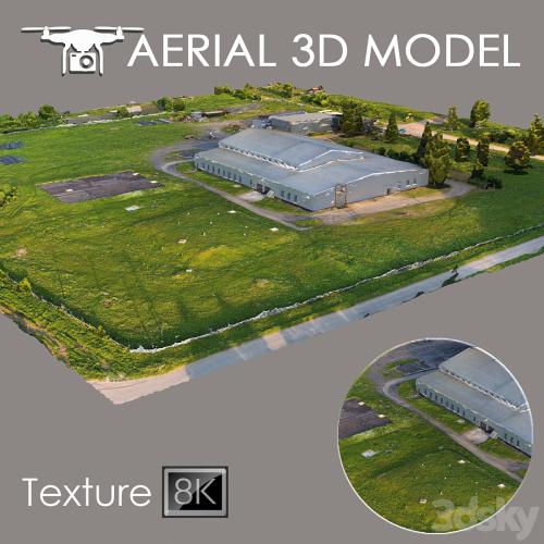
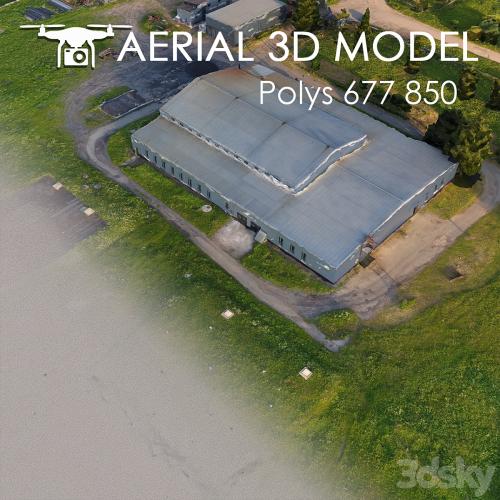
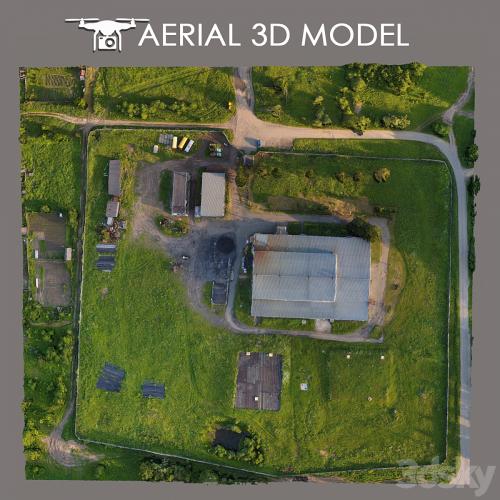
A 3D scan of the terrain was made using a quadrocopter at an altitude of 60 m.
The model consists of one Edit Poli with 1 texture scan.
Texture (scan) 8192x8192
Suitable for visualization of master plans as a background fill. The model is made on the basis of real photos and contains many details and features of the landscape.
I recommend editing the model with the Slice modifier, so you can trim the model to the desired areas.
Use only for long-range plans as a preview.

Related Posts
Information
Members of Guests cannot leave comments.
126,000 Royalty-Free 3D Model

Udemy Türkçe


Top Rated News
- CreativeLive Tutorial Collections
- Fasttracktutorials Course
- Chaos Cosmos Library
- MRMockup - Mockup Bundle
- Finding North Photography
- Sean Archer
- John Gress Photography
- Motion Science
- AwTeaches
- Learn Squared
- PhotoWhoa
- Houdini-Course
- Photigy
- August Dering Photography
- StudioGuti
- Creatoom
- Creature Art Teacher
- Creator Foundry
- Patreon Collections
- Udemy - Turkce
- BigFilms
- Jerry Ghionis
- ACIDBITE
- BigMediumSmall
- Globe Plants
- Unleashed Education
- The School of Photography
- Visual Education
- LeartesStudios - Cosmos
- Fxphd
- All Veer Fancy Collection!
- All OJO Images
- All ZZVe Vectors
- CGTrader 1 CGTrader 2